
Tropical Cyclone Dylan
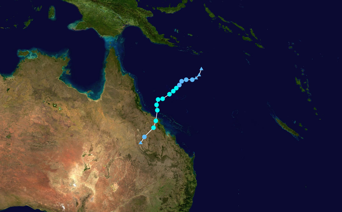
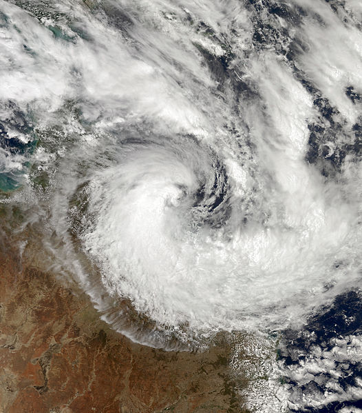
Tropical Cyclone (TC) Dylan formed on 30 January 2014, it continued to move in a southerly direction gradually intensifying and crossing the Queensland coast as a category 2 Tropical Cyclone close to Hideaway Bay with the eye of the cyclone passing over the small town of Dingo Beach at approximately 3:30am on Friday 31 January 2014.
Tropical Cyclone Dylan combined with a ridge of high pressure situated to the south of the system to cause increased tides and strong to gale force winds along a large stretch of the Queensland east coast in the days leading up to Dylan's landfall. Dylan also caused heavy rainfall along parts of the central Queensland coast and about adjacent inland areas as the system moved over the interior of the state.
Despite making landfall on a heavily populated region of the Queensland coast, damage was minimal and mainly restricted to minor flooding associated with storm surge inundation. Several houses in Townsville and Mackay sustained minor damage from seawater inundation associated with unusually high tides, while a beachside resort on Great Keppel Island sustained severe damage to many structures after the beach gave way, washing several buildings into the sea.
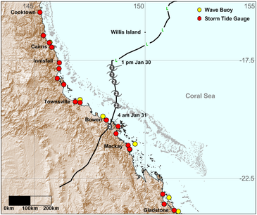
Storm surges hit near King tides during TC Dylan

The peak storm surge occurred at low tide at Shute Harbour ; however, the pre- and post- crossing storm surge in addition to the existing tide levels pushed the total water level above the
Highest Astronomical Tide level near the time of predicted high tides.
Resources: Details of TC Dylan modified from http://en.wikipedia.org/wiki/Cyclone_dylan
Storm Tide levels from: www.qld.gov.au/tides (CCBY)
Track map from Tropical Cyclone Dylan fact sheet, DSITIA (CCBY).