Tropical Cyclone Uriah
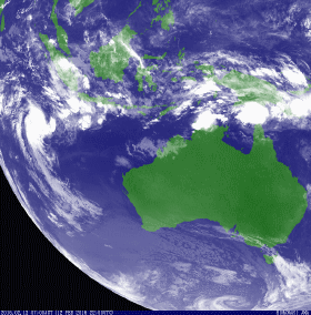
Tropical Low 09U developed over the Indian Ocean to the northwest of the Cocos (Keeling) Islands, within a monsoon trough of low pressure during 9 February 2016. Over the next few days the system moved slowly in an area of weak steering flow as it struggled to develop further, before it started moving turned to the south-west during 12 February. Later that day the system passed about 100 km (60 mi) to the northwest of the Cocos (Keeling) Islands, before conditions became favorable for further development as the system moved away from the islands. As a result, the low was named Uriah by the BoM during 13 February, as it developed into a Category 1 tropical cyclone on the Australian tropical cyclone intensity scale. The JTWC also initiated advisories on the system during that day and designated it as Tropical Cyclone 13S. Over the next day the system continued to move south-westwards and became a Category 2 tropical cyclone with 10-minute sustained winds of 95 km/h (60 mph). The system moved out of the region and into the South West Indian Ocean basin during 14 February, where it became an intense tropical cyclone before degenerating into a remnant low during 19 February.
From: https://en.wikipedia.org/wiki/2015%E2%80%9316_Australian_region_cyclone_season#Tropical_Cyclone_Uriah
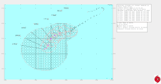
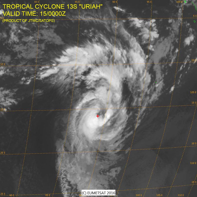
TROPICAL CYCLONE 13S (URIAH), LOCATED APPROXIMATELY 682NM WEST-SOUTHWEST OF COCOS ISLAND, AUSTRALIA, HAS TRACKED SOUTHWESTWARD
AT 08 KNOTS OVER THE PAST SIX HOURS. ANIMATED ENHANCED INFRARED SATELLITE IMAGERY CONTINUES TO DEPICT A RELATIVELY WEAK CONVECTIVE STRUCTURE. A 152101Z SSMI 85 GHZ MICROWAVE IMAGE SHOWS A BROAD LOW-LEVEL CIRCULATION CENTER WITH CONVECTIVE BANDING WRAPPING TIGHTLY INTO A WELL-DEFINED, BROAD MICROWAVE EYE FEATURE, SUPPORTING THE INITIAL POSITION WITH HIGH CONFIDENCE. UPPER LEVEL ANALYSIS INDICATES A STRONG POLEWARD OUTFLOW CHANNEL, BUT ENTRAINMENT OF DRY AIR INTO THE SYSTEM IS LIMITING INTENSIFICATION AT THIS TIME. THE CURRENT INTENSITY HAS BEEN REDUCED TO 50 KNOTS BASED ON DVORAK CURRENT INTENSITY ESTIMATES OF T3.0 FROM ALL AGENCIES. TC URIAH IS
FORECAST TO TRACK ALONG THE NORTHWESTERN PERIPHERY OF A DEEP-LAYER SUBTROPICAL RIDGE (STR) TO THE SOUTHEAST THROUGH TAU 48 THEN TURN
MORE SOUTHWARD AS THE RIDGE REPOSITIONS TO A MORE NORTH-SOUTH ORIENTATION. AFTER TAU 72, TC URIAH WILL SLOW SIGNIFICANTLY AS IT ENTERS A WEAK STEERING ENVIRONMENT AND BECOMES SANDWICHED BETWEEN TWO DEEP-LAYER RIDGES, BECOMING QUASI-STATIONARY BY TAU 96. TC URIAH IS FORECAST TO SLOWLY INTENSIFY THROUGH TAU 48 TO A PEAK INTENSITY OF 80 KNOTS BEFORE SLOWLY WEAKENING AS IT ENCOUNTERS INCREASING VWS AND LOWER SEA SURFACE TEMPERATURES. DYNAMIC MODEL GUIDANCE IS IN FAIR AGREEMENT WITH INCREASED UNCERTAINTY AFTER TAU 72, LEADING TO MODERATE CONFIDENCE IN THE JTWC FORECAST TRACK. MAXIMUM SIGNIFICANT WAVE HEIGHT AT 160000Z IS 21 FEET.
From JTWC February 16 2016