Tropical Cyclone Anika
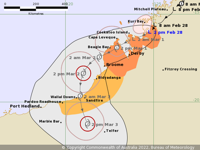
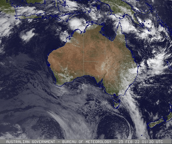
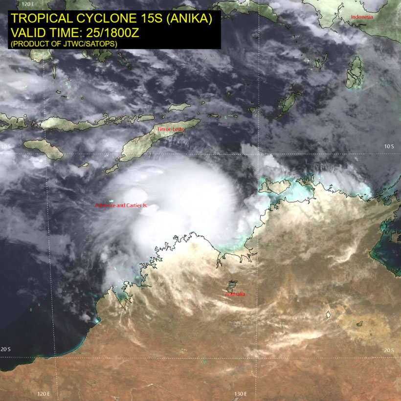
Tropical cyclone Anika developed of the far northwest coast of Western Australia on February 26 2022. Anika has weakened over the Kimberley coast on Sunday February 27 2022. Ex-Tropical Cyclone Anika is forecast to redevelop off the west Kimberley coast early Tuesday and intensify. A severe tropical cyclone impact to the east Pilbara or west Kimberley coast is forecast for late Wednesday or Thursday.
Areas Affected:
Warning Zone
Kuri Bay to Broome, including Cape Leveque, Derby, and Broome.
Watch Zone
Broome to Pardoo, including Bidyadanga and Pardoo.
Details of Ex-Tropical Cyclone Anika at 5:00 pm AWST:
Intensity: Tropical Low, sustained winds near the centre of 65 kilometres per hour with wind gusts to 95 kilometres per hour.
Location: within 35 kilometres of 16.3 degrees South 124.5 degrees East, estimated to be 90 kilometres south of Kuri Bay and 305 kilometres northeast of Broome.
Movement: southwest at 11 kilometres per hour.
Ex-Tropical Cyclone Anika continues to move slowly southwest over the northwest Kimberley. Gales are still occurring in coastal parts near the system. The low is expected to track further west-southwest across the northwest Kimberley for the remainder of tonight and early Tuesday.
Ex-TC Anika is likely to redevelop into a tropical cyclone as it moves over water near the west Kimberley coast early Tuesday, and intensify further as it moves over open ocean early Wednesday. It is expected to turn south on Wednesday, and a severe tropical cyclone impact to the east Pilbara or west Kimberley coast is forecast for late Wednesday or Thursday.
Hazards:
GALES with gusts to 100 kilometres per hour are expected along the Kimberley coast between Kuri Bay and Cape Leveque. These GALES may extend further west to Beagle Bay and Broome on Tuesday.
GALES with gusts to 100 kilometres per hour are expected to develop further west along the west Kimberley coast late Tuesday and on Wednesday, possibly extending as far west as Pardoo Roadhouse later on Wednesday.
DESTRUCTIVE winds with gusts to 140 kilometres per hour may develop across the west coast of the Dampier Peninsula, including Cape Leveque and Beagle Bay during Tuesday, if the system takes a more westerly track than forecast.
HEAVY RAINFALL is forecast about the Kimberley tonight and on Tuesday as the system tracks near the Kimberley coast.
Recommended Action:
DFES Advises the following Community Alerts:
YELLOW ALERT - For people in or around Kuri Bay to Derby, not including Derby, you need to take action and get ready to shelter from a cyclone.
BLUE ALERT - For people in or around Derby to Broome, including the Dampier Peninsula, you need to prepare for cyclonic weather and organise an emergency kit including first aid kit, torch, portable radio, spare batteries, food and water.
ALL CLEAR - Kuri Bay to Mitchell Plateau.
Remaining people in the North and West Kimberley Regions are advised to stay up to date with weather warnings and forecasts.