
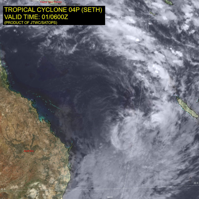
Tropical Cyclone Seth

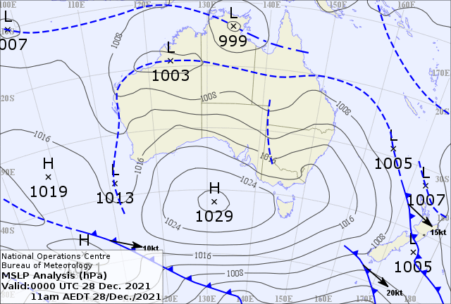
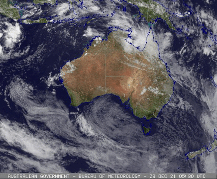
A tropical low pressure system moved across the top end of Northern Territory near Darwin and into the Gulf of Carpentaria on Wednesday 28th of December. On Thursday 30th December the system had moved over Cape Yorke Peninsular and onto the far northeast coast of Queensland. The low pressure trough continued on along the Northeast Queensland coast and developed into a tropical cyclone on New Years Eve 2021. The cyclone was named Seth and developed to a category 2 tropical cyclone while travelling southeast along the Queensland coast to Mackay where it was downgraded to a category 1 cyclone on January 1 2022.
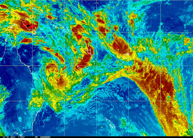
Seth continued of the southeast Queensland coast over the next 2-3 days and deteriorated to a subtropical low pressure system on the 3rd of January 2022. The system brought strong winds, rain and large waves to the Queensland coast with waves up to 6 metres. On the 3nd of January 2022 Ex-TC Seth is situated east of Brisbane moving in a northerly direction. Movement beyond this time becomes uncertain, however there is a general indication that it will drift westward closer to or over the Australian coast during next week.

Extreme waves from TC Seth
Tropical cyclone Seth generated large seas with wave heights up to 8 m and long period waves to 14 seconds off North Stadbroke Island.


Tropical cyclone Seth technical details
Tropical Cyclone Seth to produce abnormally high tides and dangerous surf about southeast Qld and northeastern NSW coast
Details of Tropical Cyclone Seth at 10:00 am AEST 02/01/2022:
Intensity: category 1, sustained winds near the centre of 85 kilometres per hour with wind gusts to 120 kilometres per hour.
Location: within 35 kilometres of 25.8 degrees South, 159.0 degrees East , 620 kilometres east of Hervey Bay and 620 kilometres east northeast of Brisbane .
Movement: south at 41 kilometres per hour .
Seth is moving in a southerly direction, and has maintained Category 1 intensity. It has started to transition into a sub-tropical system and should slow down and turn towards the southwest
on Sunday afternoon.
On Monday, Seth is expected to be weakening as it transitions further into a sub-tropical system. Movement beyond this time becomes uncertain, however there is a general indication that it
will drift westward closer to or over the Australian coast during next week.
Hazards:
The tropical cyclone is not expected to directly impact the coastline in the next 48 hours, however it will cause dangerous surf and abnormally high tides about the southeast Queensland and northeast New South Wales coastlines from Sunday. Separate Severe Weather Warnings are current for these conditions; refer to those products for more information.
Details:
| Time (AEST) | Intensity Category |
Latitude (decimal deg.) |
Longitude (decimal deg.) |
Estimated Position Accuracy (km) |
|
|---|---|---|---|---|---|
| 0hr | 10 am January 2 | 1 | 25.8S | 159.0E | 35 |
| +6hr | 4 pm January 2 | 1 | 26.4S | 158.9E | 75 |
| +12hr | 10 pm January 2 | 1 | 26.9S | 158.6E | 95 |
| +18hr | 4 am January 3 | 1 | 27.2S | 158.3E | 110 |
| +24hr | 10 am January 3 | tropical low | 27.5S | 157.8E | 120 |
| +36hr | 10 pm January 3 | tropical low | 27.2S | 157.2E | 130 |
| +48hr | 10 am January 4 | tropical low | 27.0S | 156.7E | 160 |
| +60hr | 10 pm January 4 | tropical low | 26.2S | 156.2E | 200 |
| +72hr | 10 am January 5 | tropical low | 26.1S | 155.5E | 250 |
Details of Tropical Cyclone Seth at 4:00 am AEST 01/01/2022:
Intensity: category 2, sustained winds near the centre of 95 kilometres per hour with wind gusts to 130 kilometres per hour.
Location: within 55 kilometres of 21.0 degrees South, 155.8 degrees East , 690 kilometres east of Mackay and 570 kilometres east northeast of Yeppoon .
Movement: southeast at 17 kilometres per hour .
Seth is expected to start taking a more southerly track today, before slowing and moving southwest on Sunday. Seth could weaken in the short term but is is expected to strengthen for a period later Saturday and early Sunday. On Monday, it should be weakening as it transitions into a sub-tropical system. However, movement becomes uncertain and it may move closer to or over the coast.
Hazards:
The tropical cyclone is not expected to directly affect the coastline in the next 48 hours, however it will be directing large waves towards the coast over the weekend and early next week.
TROPICAL CYCLONE INFORMATION BULLETIN
Issued at 4:53 am EST on Saturday 1 January 2022
At 4 am AEST Saturday, Tropical Cyclone Seth (Category 2) with central pressure 983 hPa was located near latitude 21.0 south longitude 155.8 east, which is about 690 km east of Mackay and 570 km east northeast of Yeppoon.
The cyclone is moving southeast at 17 kilometres per hour.
Seth is expected to start taking a more southerly track today, before slowing and moving southwest on Sunday. Seth could weaken in the short term but it is expected to strengthen for a period later Saturday and early Sunday. On Monday, it should be weakening as it transitions into a sub-tropical system. However, movement becomes uncertain and it may move closer to or over the coast.
The tropical cyclone is not expected to directly affect the coastline in the next 48 hours, however it will be directing large waves towards the coast over the weekend and early next week.
TROPICAL CYCLONE TECHNICAL BULLETIN: AUSTRALIA - EASTERN REGION
Issued by AUSTRALIAN BUREAU OF METEOROLOGY TROPICAL CYCLONE WARNING CENTRE
at: 0651 UTC 01/01/2022
Name: Tropical Cyclone Seth
Identifier: 08U
Data At: 0600 UTC
Latitude: 21.6S
Longitude: 157.3E
Location Accuracy: within 15nm (30 km)
Movement Towards: east southeast (112 deg)
Speed of Movement: 8 knots (14 km/h)
Maximum 10-Minute Wind: 45 knots (85 km/h)
Maximum 3-Second Wind Gust: 65 knots (120 km/h)
Central Pressure: 988 hPa
Radius of 34-knot winds NE quadrant:
Radius of 34-knot winds SE quadrant: 60 nm (110 km)
Radius of 34-knot winds SW quadrant: 150 nm (280 km)
Radius of 34-knot winds NW quadrant: 90 nm (165 km)
Radius of 48-knot winds NE quadrant:
Radius of 48-knot winds SE quadrant:
Radius of 48-knot winds SW quadrant:
Radius of 48-knot winds NW quadrant:
Radius of 64-knot winds: nm ( km)
Radius of Maximum Winds: 40 nm (75 km)
Dvorak Intensity Code: T2.0/2.5/W1.0/24HRS STT:W0.5/06HRS
Pressure of outermost isobar: 1004 hPa
Radius of outermost closed isobar: 320 nm (590 km)
FORECAST DATA
Date/Time : Location : Loc. Accuracy: Max Wind : Central Pressure
(UTC) : degrees : nm (km): knots(km/h): hPa
+06: 01/1200: 22.5S 158.1E: 035 (065): 045 (085): 989
+12: 01/1800: 24.0S 158.3E: 055 (100): 050 (095): 986
+18: 02/0000: 25.4S 158.3E: 070 (125): 050 (095): 985
+24: 02/0600: 26.1S 158.0E: 080 (150): 050 (095): 983
+36: 02/1800: 26.8S 157.1E: 095 (180): 040 (075): 990
+48: 03/0600: 27.1S 156.4E: 100 (190): 035 (065): 993
+60: 03/1800: 26.8S 155.7E: 125 (230): 035 (065): 993
+72: 04/0600: 26.4S 155.2E: 170 (310): 035 (065): 993
+96: 05/0600: 25.4S 153.8E: 265 (490): 030 (055): 997
+120: 06/0600: 25.6S 152.7E: 320 (590): 025 (045): 999
REMARKS:
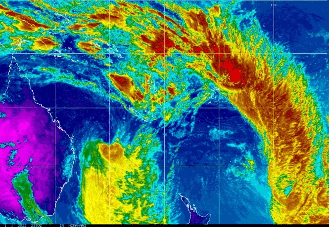
Tropical Cyclone Seth is struggling to maintain any deep convection close to the low level circulation centre. The LLCC itself has become broader on visible imagery with multiple smaller vortices evident.
Dvorak is based on a shear pattern with the LLCC just within 60nm of some fairly stale deep convection. DT is 2.0. MET is 1.5 based on a 24 hour W+ trend. The shear pattern was considered less reliable in this situation, so FT
was based on MET, however held to 2.0 by constraints. CI is held at 2.5. Intensity is maintained at 45 knots. This is above the subjective Dvorak, but broadly consistent with recent CIMSS ADT and SATCON estimates of 47 and 48
knots respectively (1 minute means). The morning ASCAT pass showed no gales in eastern quadrants, however some deeper convection has recently moved into the SE quadrant. Gales are persisting in the southwestern quadrant as evidenced by the Cato Island automatic weather station.
The CIMMS 03Z wind shear analysis shows the system under NW'ly shear of 20 to 25 knots, however there is some uncertainty in this value as the system lies on a strong shear gradient south of the upper ridge. This shear should be maintained or increase further in the short term. However, the weakening this implies may be countered by an increasing baroclinic influence on the system from the amplifying upper trough to the west. This may be sufficient to sustain gale or even storm force winds overnight tonight and into Sunday. Recent NWP continues to suggest the system will undergo some (most likely baroclinic) intensification overnight tonight.
Through Sunday the system will become increasingly sub-tropical, and is expected to transition into a fully sub-tropical low on or by Monday. Movement is currently east-southeast. The system is expected to turn south
overnight and then southwest during Sunday more or less "around" the mid-level low approaching from the west. Beyond that, steering influences are finely balanced with mid-level anticyclones to the east and west, and
uncertainty in the track becomes high. The most significant hazard to coastal communities in the short to medium term is large waves and abnormally high tides that could affect a significant stretch of coastline over the duration of this event.
From www.bom.gov.au