Tropical Cyclone Damien
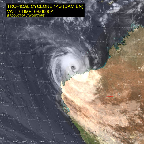
Tropical cyclone Damien developed into a category 3 cyclone off the WA North coast.
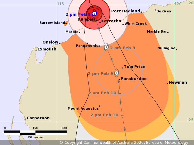
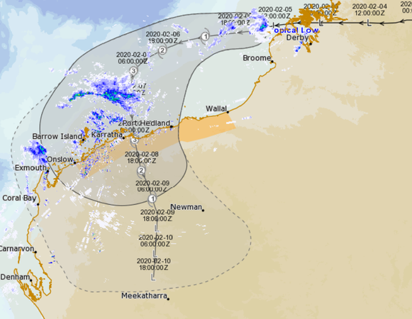
Severe Tropical Cyclone Damien is located off the northwest coast of WA and this system is intensifying as it moves towards the coast. Extensive rain and thunderstorm activity is occurring with this system which is now
affecting the Pilbara coast.
Details of Severe Tropical Cyclone Damien at 2:00 pm AWST:
Intensity: category 3, sustained winds near the centre of 150 kilometres per hour with wind gusts to 205 kilometres per hour.
Location: within 20 kilometres of 20.4 degrees South, 116.6 degrees East , 50 kilometres north northwest of Karratha and 210 kilometres northeast of Onslow.
Movement: south southeast at 13 kilometres per hour.
Severe Tropical Cyclone Damien is near the central Pilbara coast. Damien is likely to cross the coast near Dampier in the next few hours as a severe tropical cyclone.
Hazards: GALES are occuring along the coast of the central Pilbara between Whim Creek and Mardie, including Karratha and Dampier. Gales may extend westward to Onslow this afternoon, as well as to adjacent inland parts of the central Pilbara.
DESTRUCTIVE winds with wind gusts to 150 kilometres per hour are occurring between Roebourne and Cape Preston. VERY DESTRUCTIVE winds with gusts up to 220 kilometres per hour are occurring near the cyclone centre, including near Karratha, as the cyclone nears the coast. GALES should extend further inland through the central Pilbara and into the northeast Gascoyne tonight and on Sunday as the cyclone tracks further inland.
Residents between Dampier and Whim Creek, including Dampier and Karratha, are warned of the potential of a VERY DANGEROUS STORM TIDE as the cyclone centre crosses the coast. Tides are likely to rise significantly above the normal high tide mark with DAMAGING WAVES and VERY DANGEROUS FLOODING.
Heavy rain is likely to cause flooding in the Pilbara and Gascoyne as the cyclone moves inland over the weekend. Flood Watches and Warnings are current, please refer to http://www.bom.gov.au/wa/warnings/ for further details.