Tropical Cyclone Ilsa
Tropical cyclone Ilsa (il-suh) developed off the north Western Australian coast on Tuesday April 11 2023. Ilsa developed to a category 5 Severe Tropical Cyclone on April 13 2023 and continued moving towards the north Western Australian coast before making landfall southwest of Broome around 16:30 on Thursday April 13 2023. Ilsa deteriated to a low pressure system as it travelled over land towards the east.
Details of Severe Tropical Cyclone Ilsa
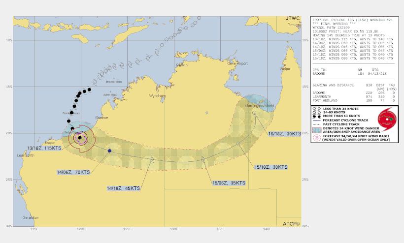
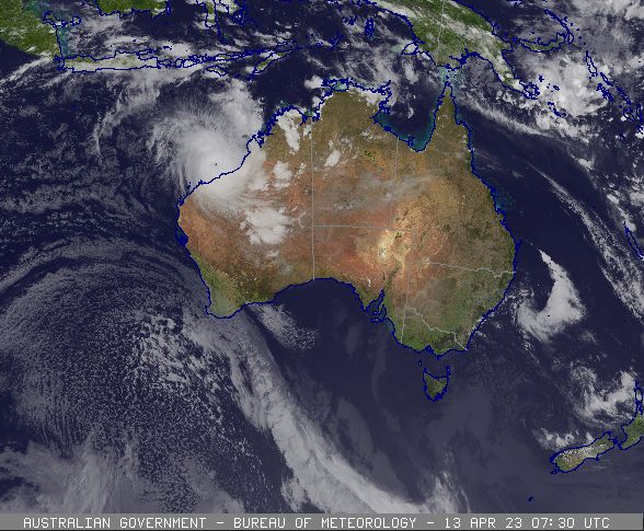
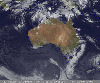
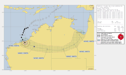
A tropical low that formed in the Timor Sea on 6 April moved southwest and developed slowly. It reached tropical cyclone intensity at 0600 UTC 11 April (1400 AWST 11 April, AWST = UTC+8 hours), about 400 km to the north northwest of Broome. During 11 April the environment became more favourable for development and the cyclone underwent rapid intensification. Ilsa reached severe category three strength by 0000 UTC 12 April, only eighteen hours after formation.
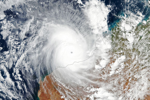
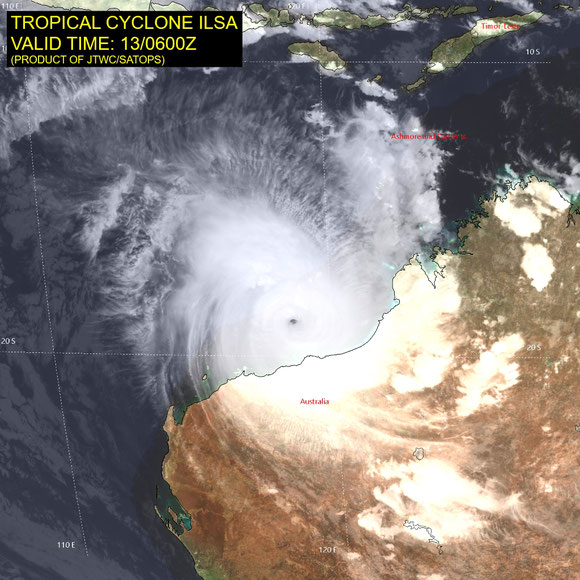
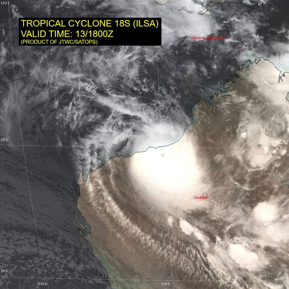
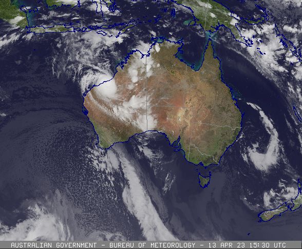
The movement of Ilsa began to slow during 13 April and it turned south towards the Pilbara coast. Ilsa continued to intensify under favourable conditions and reached category 5 strength at 0600 UTC 13 April, some 180 kilometres to the north of Port Hedland. Severe Tropical Cyclone Ilsa turned to the southeast from this point and accelerated towards the Pilbara coast, crossing near the Pardoo Roadhouse at 1600 UTC 13 April, around midnight local time, with a peak 10-minute mean wind intensity of 125 kn (230 km/h).
Once the tropical cyclone crossed the coast and moved inland it began to weaken, decreasing below Category 3 intensity by 0600 UTC 14 April and then below tropical cyclone intensity by 1200 UTC 14 April over eastern parts of inland Western Australia. Ilsa crossed the Pilbara coast in a relatively sparsely populated location; which limited the reported damage. However, the Pardoo Roadhouse and pastoral stations, including Pardoo and Warrawagine, sustained severe damage. Other communities along the track further inland such as Telfer, Punmu and Parnngurr experienced mostly minor building damage.
Heavy rainfall was recorded along the track but no significant flooding was experienced. Two Indonesian fishing boats were caught in the path of Ilsa off Rowley Shoals. One boat sank with at least nine fishermen feared drowned. The other boat ran aground at Bedwell Island on the northern end of Rowley Shoals. The eleven Indonesian fishermen survived six days without food and water before being rescued. Ilsa also had a destructive impact on bird colonies particularly the brown boobies and frigate birds on Bedout Island.
Ilsa passed directly over the Bureau of Meteorology's offshore observing sites at Rowley Shoals and Bedout Island as well as the inland site of Telfer. The peak 118 kn (219 km/h) 10-minute mean wind observation and the 155.9 kn (289 km/h) wind gust at Bedout Island are the highest known recorded on a standard Bureau instrument. Although it is still significantly lower than the gust recorded on Barrow Island in Olivia (for the full report see http://www.bom.gov.au/jshess/docs/2012/courtney_hres.pdf).
Summary from the Severe Tropical Cyclone report: http://www.bom.gov.au/cyclone/history/Ilsa23.shtml
Severe Tropical Cyclone Ilsa images