Tropical Cyclone Marcia 

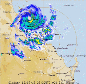
TC Marcia crossed the central Queensland coast as a Severe Tropical Cyclone, Category 5

Satellite animation of Tropical Cyclone Marcia (and TC Lam) approaching the Australian coast. Images sourced from www.bom.gov.au
Satellite animation of Tropical Cyclone Marcia (and TC Lam in the NT) approaching the Australian coast. Images sourced from www.bom.gov.au
Tropical Cyclone Marcia, animated veiw of rainfall after crossing the Queensland coast. Images are a compilation of rain radar images from www.bom.gov.au

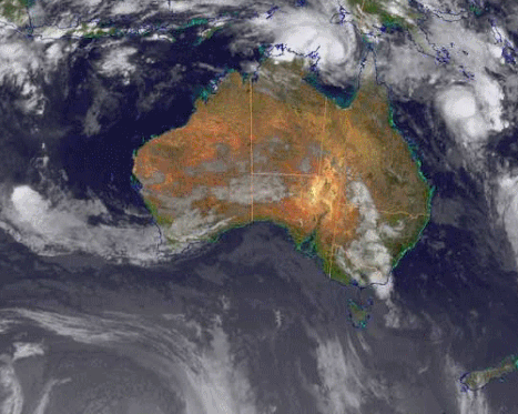
On 18 February 2015 the Bureau of Meteorology (BoM) declared a cyclone watch for a developing tropical low in the Coral Sea off the coast of North Queensland. Tropical Cyclone (TC) Marcia was announced on Thursday, 18 February 2015.


The low initially tracked eastward before turning and developing into a tropical cyclone, taking a south-westerly path while intensifying to cross the coast as a category 5 Severe Tropical Cyclone at Shoalwater Bay at approximately 08:00 (EST) 20 February. TC Marcia continued to track south over the following days, deteriorating to a low and then travelling off-shore from south east Queensland. 

Track of Tropical Cyclone Marcia. From TC Marcia fact sheet.
Tropical Cyclone Marcia storm surge forecast. From European Commission, GDAC, http://www.gdacs.org/