Tropical Cyclone Owen
Severe Tropical Cyclone Owen dubbed a zombie cyclone.

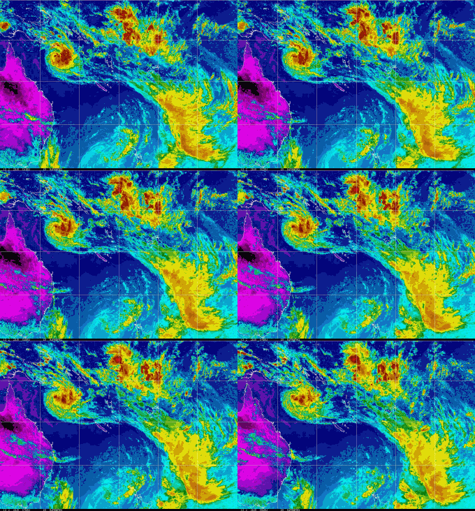
STC Owen, formed, decayed then reformed, so the media called Owen a Zombie Cyclone after the latest movie craze where zombies return from the dead.
First December Cyclone
Severe Tropical Cyclone Owen was the first tropical cyclone to develop in the 2018-19 season and the first cyclone in December in waters off Queensland since 1997.
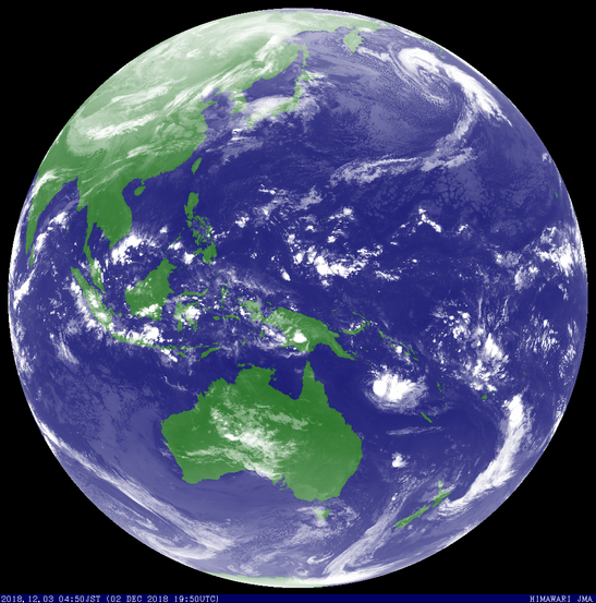
Tropical cyclone Owen formed in the Coral Sea on 3 December 2018 as a category 1 tropical cyclone. TC Owen developed further into a category 2 cyclone before vertical wind shear weakened the system as it moved west towards the Queensland coast, effectively decaying back to a tropical low on 5 December.
10 December 2018
Ex Tropical Cyclone Owen moved towards the Queensland coast and crossed on 10 December near Townsville. A storm surge and large waves were reported along the North Queensland coast. Inundation across the coast was not reported as the cyclone crossed during the lower neap tides.
Ex-Tropical Cyclone Owen traveled westwards across the Cape York Peninsula and entered the eastern Gulf of Carpentaria in the early hours of Tuesday morning. Ex-Tropical Cyclone Owen is expected to redevelop into a tropical cyclone on Wednesday over the southern Gulf of Carpentaria.
Tropical Cyclone Owen developed into a category 2 cyclone in the Gulf of Carpentaria 12 December 2018 while traveling westward. The slow moving cyclone developed to category 3 after turning back to the east.
Severe Tropical Cyclone (STC) Owen developed to a cat 4 cyclone, then crossed back over Cape Yorke Peninsular to the North of Pormparaaw.


Details of Severe Tropical Cyclone Owen at 5:30 pm ACST
Severe Tropical Cyclone Owen has weakened slightly over the last 6 hours, but
due to the slow movement of the system there is good confidence in the location
from satellite imagery. Recent motion [over last 3 hours] has been slowly
northeast.
Due to the weakening of the system over the last 6 hours dvorak analysis is
problematic. An unclear DT of around 3.5-4. Using the VIS the diurnal trend
shows a slight development [D-], giving a MET 4, but PAT was adjusted to 4.5. FT
4.5 [biased to PAT]. NESDIS ADT at 0430 UTC was 4.9 [Raw 3.8] and CIMSS ADT at
0510 UTC was 4.8 [Raw 3.5]. SATCON around 80 knots [1 min]. Maximum 10 minute
mean winds for Severe TC Owen estimated to be 75 knots.
CIMSS shear was around 10-15 knots from the north northeast at 00UTC.
There is strong consensus across all models that Owen will continue to move east
during the remainder of Thursday and Friday due to an amplifying middle level
trough and cut off low sweeping across SE Australia. The majority of the models
take Owen over the SE Gulf of Carpentaria, with landfall most likely later on
Friday or early Saturday between Gilbert River Mouth to Pormpuraaw.
Owen has weakened after brushing the southwest coast of the Gulf of Carpentaria.
However, the system is likely to intensify over the next 24 hours as it moves
eastwards over water. The environment over the Gulf of Carpentaria is favourable
for development with SSTs 30-31C and low to moderate wind shear. Deep moisture
surrounds the system. Good poleward upper outflow is visible from satellite
imagery.
In the longer term, Owen is expected to track close to or move off the eastern
Queensland coast during the weekend or early next week. Both EC and GFS
indicate a strong system with gales over eastern quadrants. Embedded deep within
the mid-lat westerlies, ETT may be a possibility. However GFS cyclone phase
prognostic suggests it retains its warm core. Either way, gales and significant
rainfall are possible along the central Qld coast this weekend or early next
week.
Details of Tropical Cyclone Owen at 6:30 pm ACST [7:00 pm AEST]:
Intensity: Category 2, sustained winds near the centre of 95 kilometres per hour with wind gusts to 130 kilometres per hour.
Location: within 45 kilometres of 14.9 degrees South 136.8 degrees East, estimated to be 100 kilometres south southeast of Groote Eylandt and 140 kilometres north northeast of Borroloola.
Movement: west at 9 kilometres per hour.
Tropical Cyclone Owen is located over the southwestern Gulf of Carpentaria and is moving slowly towards the west. Owen will become slow moving overnight before tracking towards the east, back towards the Queensland coast during Thursday. If Owen tracks more towards the south or west overnight Wednesday into early Thurday, it may be located near the coast between Port Roper and Port McArthur before commencing its eastward track during Thursday. Owen may reach category 3 intensity by Thursday morning if conditions remain favourable. A coastal crossing along the southeast Gulf of Carpentaria coast between Karumba to Pormpuraaw later Friday is likely.
Hazards:
GALES with gusts up to 110 kilometres per hour may develop between Alyangula and the NT/Qld Border, including Groote Eylandt during the remainder Wednesday. On Thursday, GALES may extend to Burketown, including Mornington Island, and then extend further to the southeast Gulf of Carpentaria between Burketown and Cape Keerweer and adjacent inland areas on Friday.
DESTRUCTIVE WINDS with gusts to 130 kilometres per hour may develop along the coast near Port Roper and to the NT/Qld Border late on Wednesday and early Thursday. On Friday DESTRUCTIVE WINDS with gusts to 130 kilometres per hour may develop between Pormpuraaw and Karumba as the system approaches the Queensland coast.
VERY DESTRUCTIVE WINDS with gusts to 170 km/h may develop along the coast near Port Roper and the NT/Qld border from Thursday morning if TC Owen strengthens to category 3 near the coast. If Owen maintains category 3 intensity during Friday VERY DESTRUCTIVE winds are possible between Kowanyama and Gilbert River Mouth later on Friday.
HEAVY RAINFALL, which may lead to flash flooding, is likely to develop about the islands and coastal areas of the western and southern Gulf of Carpentaria on Wednesday and Thursday.
As the cyclone approaches the coast a STORM TIDE between Port McArthur and Karumba may develop as the cyclone approaches the coast. Tides may rise significantly above the normal high tide, with DAMAGING WAVES and MINOR FLOODING between Port McArthur and Karumba. Tides will be higher than normal and large waves may produce minor flooding between Port McArthur and Alyangula.
Details of Tropical Cyclone Owen 4:00 am AEST 12122018
Intensity: Category 1, sustained winds near the centre of 75 kilometres per hour with wind gusts to 100 kilometres per hour.
Location: within 30 kilometres of 14.8 degrees South 137.9 degrees East, estimated to be 170 kilometres east southeast of Groote Eylandt and 220 kilometres northeast of Borroloola.
Movement: west northwest at 12 kilometres per hour.
Tropical Cyclone Owen is located northwest of Mornington Island. It is expected to continue moving westwards during Wednesday and then change course to move eastwards and back towards the Queensland coast on Thursday. It may reach category 3 intensity by Thursday if conditions remain favourable. A coastal crossing along the southeast Gulf of Carpentaria coast during Friday is most likely.
Details of Ex-Tropical Cyclone Owen at 4:00 pm AEST 11122018:
Intensity: tropical low, sustained winds near the centre of 55 kilometres per hour with wind gusts to 85 kilometres per hour.
Location: within 30 kilometres of 15.1 degrees South, 139.2 degrees East , 175 kilometres north of Mornington Island and 330 kilometres east northeast of Borroloola .
Movement: west northwest at 15 kilometres per hour .
Ex-Tropical Cyclone Owen is located north of Mornington Island. It is expected to continue moving steadily westwards during the rest of today and is likely to redevelop into a tropical cyclone tonight over the southern Gulf of Carpentaria. During Wednesday or Thursday, the tropical cyclone is expected to slow down and turn back towards the Queensland coast and may reach category 3 intensity if conditions remain favourable. A coastal crossing along the southeast Gulf of Carpentaria coast during Friday is most likely.
Ex-Tropical Cyclone Owen details 10/12/2018
at 3:30 pm ACST [4:00 pm AEST]:
Intensity: Tropical Low, sustained winds near the centre of 35 kilometres per hour with wind gusts to 85 kilometres per hour.
Location: within 45 kilometres of 16.0 degrees South 143.0 degrees East, estimated to be 145 kilometres east southeast of Kowanyama and 720 kilometres east of Borroloola.
Movement: west at 13 kilometres per hour.
Ex-Tropical Cyclone Owen is moving westwards across the Cape York Peninsula and is expected to enter the eastern Gulf of Carpentaria in the early hours of Tuesday morning. Ex-Tropical Cyclone Owen is expected to redevelop into a tropical cyclone on Wednesday over the southern Gulf of Carpentaria. During Wednesday or Thursday, the tropical cyclone is expected to slowly turn towards the southeast and may reach category 3 intensity if conditions remain favourable.
Technical details 03122018
IDQ20065
Australian Government Bureau of Meteorology
Queensland Region
Tropical Cyclone Warning Centre
TROPICAL CYCLONE INFORMATION BULLETIN
For 4:45 am EST on Monday 3 December 2018
At 4 am AEST Monday, Tropical Cyclone Owen, category 1, with central pressure
995 hPa was located over the northern Coral Sea near latitude 15.2 south
longitude 154.9 east, which is about 540 km east northeast of Willis Island and
1000 km east of Cairns.
Tropical cyclone Owen has continued moving south-southeast during the past few
hours. Owen is expected to intensify further and is likely to reach Category 2
later today.
Tropical cyclone Owen is expected to slow and turn westward later today or
tonight. It should begin to weaken during Tuesday. The cyclone should be
relatively slow moving, and poses no immediate threat to the Queensland coast.
It should remain well off the coast until it weakens later in the week.
From www.bom.gov.au


