Tropical Cyclone Megan

Severe Tropical Cyclone Megan crossed the southwestern Gulf of Carpentaria coast of the Northern Territory (NT) on 18 March 2024.
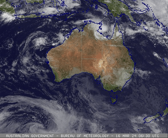
A tropical low formed near the Tiwi Islands, north of Darwin, late on 13 March associated with a burst in the monsoonal flow to the north. Gale-force winds were observed north of the centre as the low moved eastwards close to the Top End coast. Heavy rainfall and flooding affected some Top End communities during this period. The low emerged into the Gulf of Carpentaria on 15 March 2024.
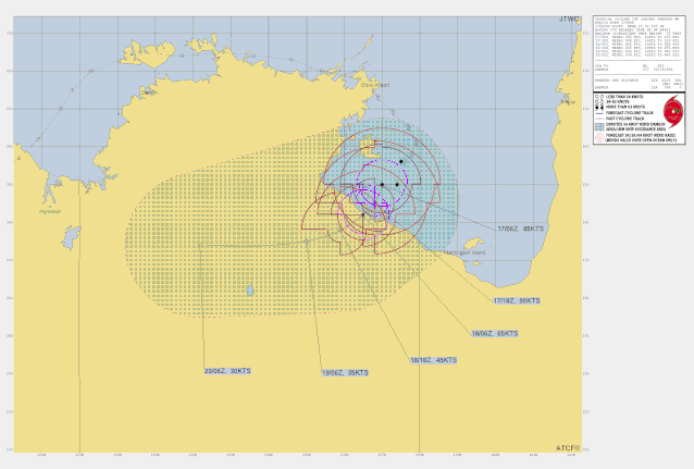
The low became slow moving to the east of Groote Eylandt on 16 March and reached tropical cyclone intensity. At Groote Eylandt gale-force winds late on 16 March caused significant damage to vegetation and the wharf was badly damaged as the Manganese bulk carrier MV Anikitos was pushed against it.
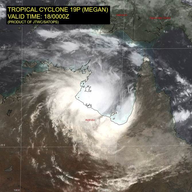
Megan quickly reached category 2 intensity on 16 March and then category 3 intensity on 17 March as it moved slowly to the south southwest, peaking at the top of the category 3 scale overnight from 17 to 18 March. Megan crossed the southwestern Gulf of Carpentaria coast, about 45 km southeast of Port McArthur, as a category 3 cyclone on the afternoon of 18 March having weakened slightly ahead of landfall. Megan quickly weakened as it moved inland and was downgraded to a tropical low overnight from 18 to 19 March.
The slow movement of the cyclone resulted in very intense rainfall and flooding being recorded at Groote Eylandt, and in catchments along the southern Gulf of Carpentaria coast during this event. Groote Eylandt Airport recorded a two-day total of 680.4 mm and Borroloola recorded a two-day total of 370.6 mm. A record Major flood level was recorded in the McArthur River on 22 March. Flooding forced the evacuation of many Borroloola residents.
Fortunately, Megan crossed an unpopulated part of the coast hence there was minimal wind impacts along the southwest Gulf coast. An aerial survey by the NT Department of Environment, Parks and Water Security of the coastline around landfall area found no stranded marine megafauna and no evidence of any storm surge damage. Flooding associated with ex-Tropical Cyclone Megan damaged major highways and several secondary roads along its path across the Northern Territory during late March.
From www.bom.gov.au