Tropical Cyclone Veronica
Tropical Cyclone Veronica

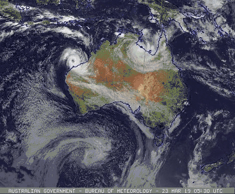
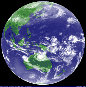
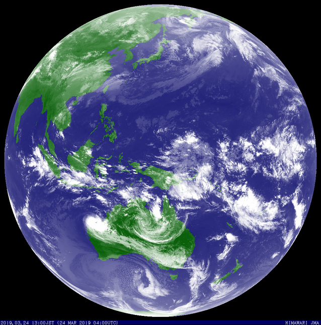
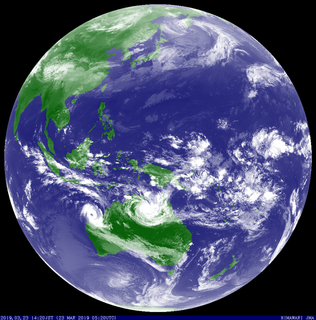
Tropical Cyclone veronica formed 20 March 2019 and developed to category 2 level off the Northern Western Australian coast (Pilbara region). Veronica moved South West before turning towards the WA coast and developing into a category 4 Severe Tropical Cyclone. Severe Tropical Cyclone Veronica traveled very close to the WA coast near Port Hedland as a category 3 cyclone on Sunday 24 March. Veronica weakened as it moved South West along the coast over the 25 and 26 March 2019.
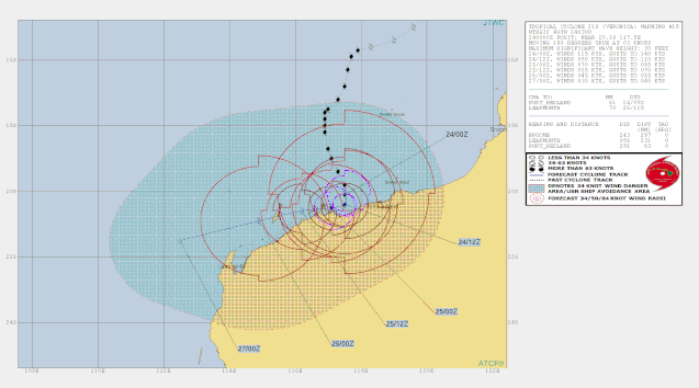
Details of Severe Tropical Cyclone Veronica at 11:00 am AWST 24 March 2019:
Severe Tropical Cyclone Veronica is causing DESTRUCTIVE winds and heavy rainfall on the central Pilbara coast between Dampier and Port Hedland.
Areas affected:
Warning zone: Wallal to Mardie, including Port Hedland and Karratha, and adjacent inland areas, including Pannawonica.
Intensity: category 3, sustained winds near the centre of 155 kilometres per hour with wind gusts to 220 kilometres per hour.
Location: within 30 kilometres of 20.3 degrees South, 117.7 degrees East , 90 kilometres west of Port Hedland and 100 kilometres east northeast of Karratha.
Movement: south southeast at 6 kilometres per hour .
The cyclone's core has reached land and is over the coast just east of Roebourne and west of Port Hedland. The centre is forecast to remain near the coast today and tonight. Veronica is forecast weaken during Monday and start moving to the west.
Hazards:
VERY DESTRUCTIVE WINDS with gusts in excess of 165 kilometres per hour are expected near the cyclone centre today and tonight. This includes Roebourne, Wickham and Point Samson.
DESTRUCTIVE WINDS with gusts exceeding 125 kilometres per hour are occurring along the Pilbara coast between Dampier and Port Hedland and are forecast to extend to adjacent inland areas today with gusts to 100 kilometres per hour are expected between remaining parts between Mardie and Pardoo, and may extend to adjacent inland areas including Pannawonica later today. They may also extend east of Wallal Downs tonight if the system moves further east.
The slow movement of the cyclone means that communities in the path of the cyclone should prepare to shelter from the destructive winds for an extended period today and into tomorrow.
Widespread very heavy rainfall conducive to MAJOR FLOODING is likely over the Pilbara coast and adjacent inland areas today and Monday. Heavy rainfall is expected to result in significant river rises, areas of flooding and hazardous road conditions. Some roads may become impassable and some communities may become isolated. Flood Warnings and Watches are current, please refer to http://www.bom.gov.au/wa/warnings/ for further details.
People along the Pilbara coast east of Wickham are warned of the potential for a VERY DANGEROUS STORM TIDE on the high tide today (high tide at 1pm at Port Hedland) and tonight (high tide at 1:30am Monday at Port Hedland). Tides are likely to rise significantly above the normal high tide mark with DAMAGING WAVES and VERY DANGEROUS COASTAL INUNDATION. Tides in remaining areas of the warning area are advised that tides will rise above the normal high tide with some flooding of low-lying coastal areas.
From www.bom.gov.au
Technical details
240300Z POSITION NEAR 20.2S 117.5E.
TROPICAL CYCLONE (TC) 21S (VERONICA), LOCATED APPROXIMATELY 231 NM
NORTHEAST OF LEARMONTH, AUSTRALIA, HAS TRACKED SOUTHWARD AT 03
KNOTS OVER THE PAST SIX HOURS. ANIMATED ENHANCED INFRARED
SATELLITE IMAGERY DEPICTS A CONSOLIDATING SYSTEM WITH TIGHTLY-CURVED
BANDING WRAPPING INTO A 15-20NM IRREGULAR EYE, WHICH SUPPORTS THE
INITIAL POSITION WITH GOOD CONFIDENCE. DESPITE DRY AIR ENTRAINING
AROUND THE PERIPHERY OF THE SYSTEM AND ERODING DEEP CONVECTIVE
BANDING, BOTH RADAR IMAGERY AND TOTAL PRECIPITABLE WATER VAPOR
IMAGERY INDICATE THAT THE SYSTEM HAS BEEN ABLE TO MAINTAIN A MOIST
CORE AND THE EYEWALL CONVECTION. ADDITIONALLY, THE CORE HAS REMAINED
OVER WATER AND THE TERRAIN OVER THIS COASTAL REGION IS RELATIVELY
FLAT AND MOIST. CONSEQUENTLY, DVORAK INTENSITY ESTIMATES HAVE
INCREASED AND CURRENTLY RANGE FROM T5.0 (90 KNOTS) TO T6.0 (115
KNOTS). ADVANCED DVORAK TECHNIQUE ESTIMATES JUMPED BRIEFLY TO 6.2
(ABOUT 118 KNOTS) BUT HAVE DECREASED BACK TO 5.7 (ABOUT 110 KNOTS)
THUS THE INITIAL INTENSITY IS DIFFICULT TO ACCURATELY ASSESS AND IS
CONSERVATIVELY INCREASED TO 115 KNOTS. THE STRONGEST SURFACE WINDS
OCCURRED AT LEGENDRE ISLAND AT 232103Z, ABOUT 40NM WEST-SOUTHWEST OF
THE CENTER, WITH PEAK SUSTAINED WINDS (10-MINUTE AVERAGE) AT 61
KNOTS GUSTING TO 85 KNOTS (NOTE THAT OBSERVATION REPORTS CEASED AT
232230Z LIKELY DUE TO SENSOR PROBLEMS). POLEWARD OUTFLOW REMAINS
ROBUST WITH A STRONG POLEWARD OUTFLOW CHANNEL INTO THE WESTERLIES TO
THE SOUTH AND LOW TO MODERATE VERTICAL WIND SHEAR. TC 21S IS
FORECAST TO TRACK SLOWLY SOUTHWARD THROUGH TAU 12 ALONG THE WESTERN
PERIPHERY OF A WEAK INDUCED STEERING RIDGE, WHICH IS POSITIONED
BETWEEN TC 21S AND TC 20P. AS THE SYSTEM TRACKS CLOSER TO THE
NORTHWEST COAST OF AUSTRALIA AND WEAKENS SIGNIFICANTLY DUE TO LAND
INTERACTION, DRY AIR ENTRAINMENT AND INCREASING VERTICAL WIND SHEAR,
TC 21S IS FORECAST TO SLOW AS A STRONG LOW-LEVEL HIGH BUILDS OVER
SOUTHWESTERN AUSTRALIA WITH THE REMNANTS OF THE SYSTEM EXPECTED TO
TRACK WESTWARD TO WEST-SOUTHWESTWARD. THERE IS A POSSIBILITY THAT
THE REMNANTS MAY TRACK CLOSER TO LEARMONTH, HOWEVER, THERE IS A HIGH
CERTAINTY THAT THE SYSTEM WILL REMAIN A WEAK REMNANT LOW DUE TO THE
PRESENCE OF STRONG UPPER-LEVEL NORTHWESTERLY FLOW PERSISTING OVER
NORTHWEST AUSTRALIA (LEARMONTH SOUNDING CURRENTLY SHOWS WESTERLY
WINDS OF 45 KNOTS NEAR 300MB). OVERALL, THERE IS LOW CONFIDENCE IN
THE JTWC FORECAST TRACK DUE TO UNCERTAINTY IN THE TRACK SPEEDS AND
TIMING OF THE WESTWARD TURN WITH A 206NM SPREAD IN SOLUTIONS AT TAU
72. MAXIMUM SIGNIFICANT WAVE HEIGHT AT 240000Z IS 30 FEET.
From JTWC