Tropical Cyclone Errol

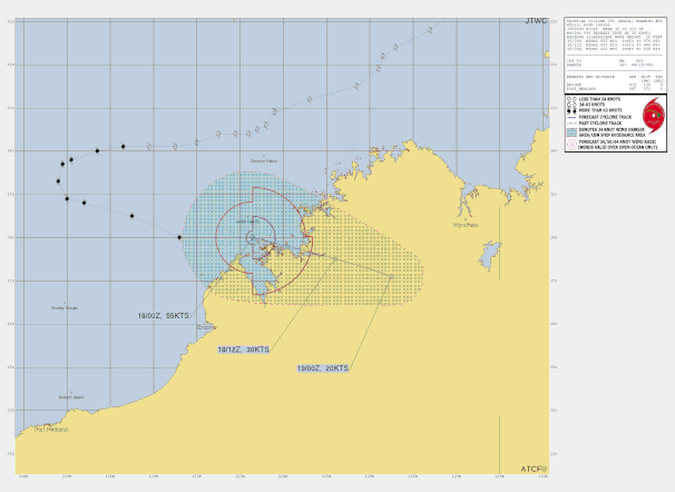
Tropical cyclone Errol developed of the Kimberly coast on April 14 2025. Errol moved towards the southwest and away from the coast while developing to a category 3 severe tropical cyclone on April 16. Severe tropical cyclone Errol then turned easterly towards the Western Australian coast while conditions to develop further deteriorated and STC Errol began weakening. Errol continued moving to the east towards the west Kimberley coast and crossed the coast south of Kuri Bay as a low pressure system on April 18 2025.

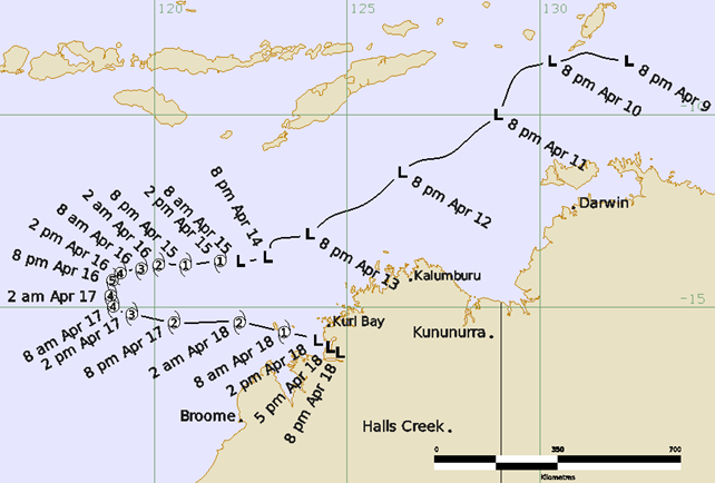
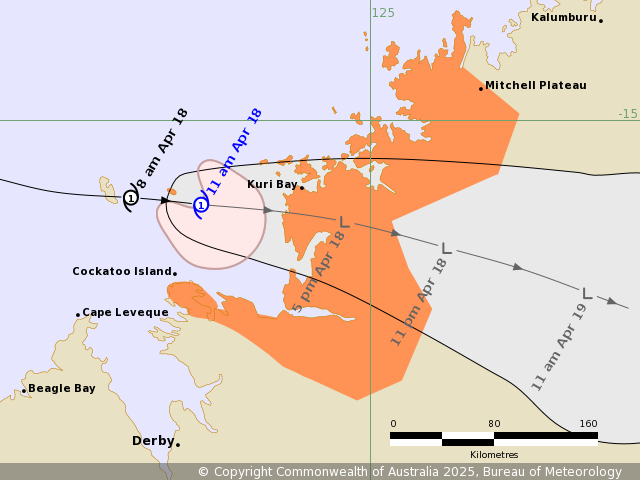
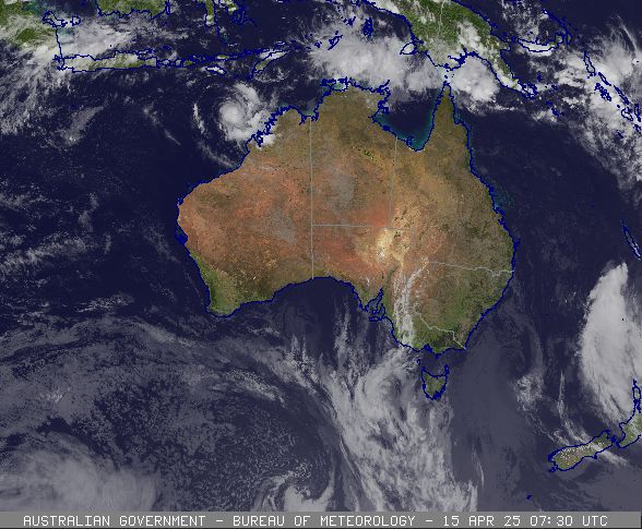
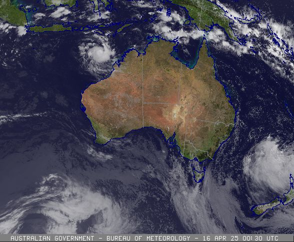
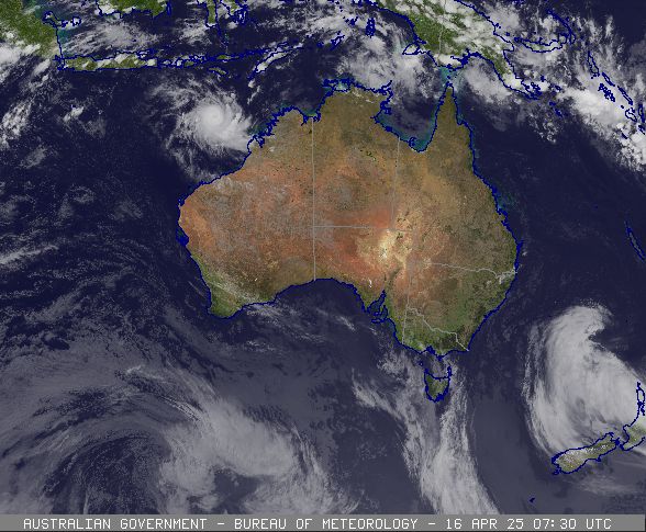
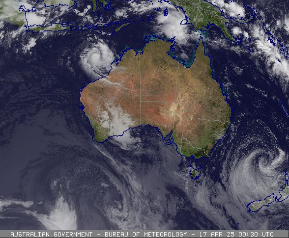
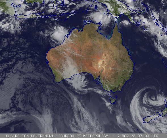
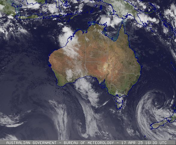
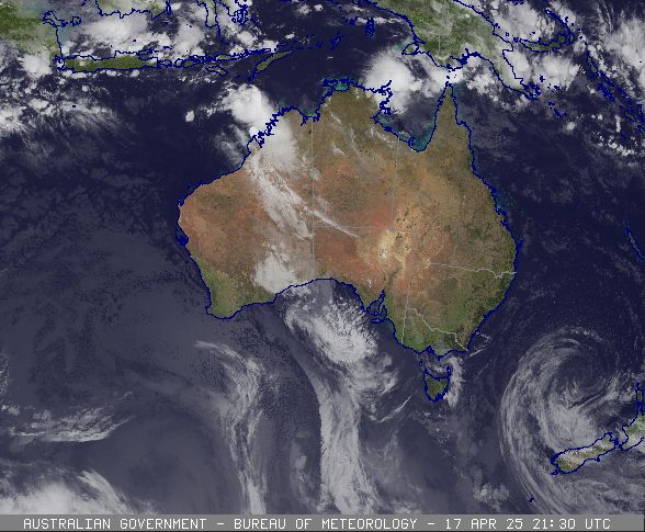
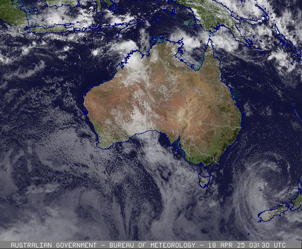
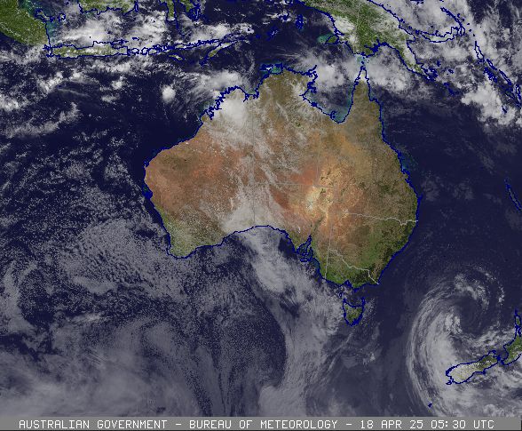
Track map and satellite images of the passage of severe tropical cyclone Errol.

Track map and details of severe tropical cyclone Errol near the Kimberley coast, April 18 2025. From JTWC.
Satellite image of severe tropical cyclone Errol near the Kimberley coast, April 18 2025. Image from JTWC.
Satellite image of severe tropical cyclone Errol near the Kimberley coast, April 16 2025. Image from JTWC.
Satellite image showing severe tropical cyclone Errol near the Kimberley coast, April 18 2025. Image from www.bom.gov.au
Satellite image showing severe tropical cyclone Errol near the Kimberley coast, April 17 2025. Image from www.bom.gov.au
Satellite image showing severe tropical cyclone Errol near the Kimberley coast, April 16 2025. Image from www.bom.gov.au