Tropical Cyclone Mitchell
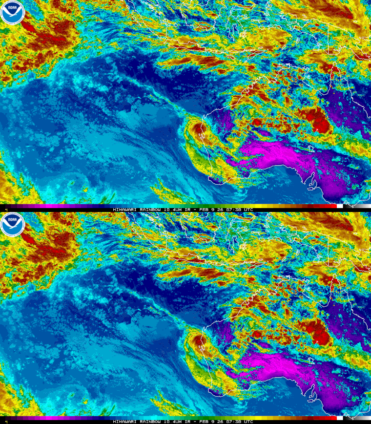
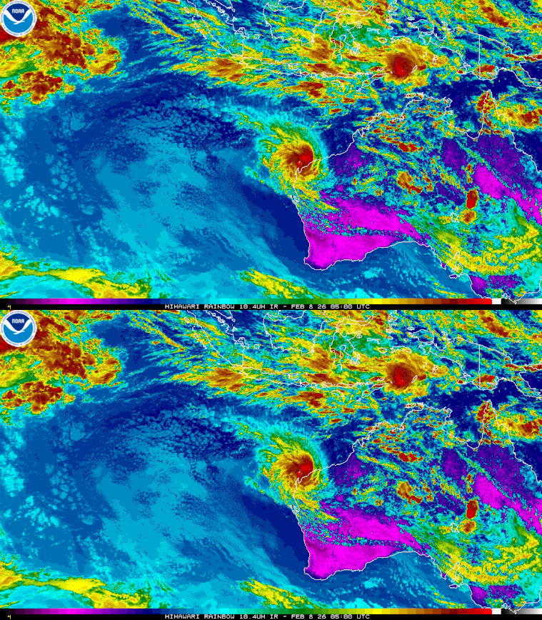
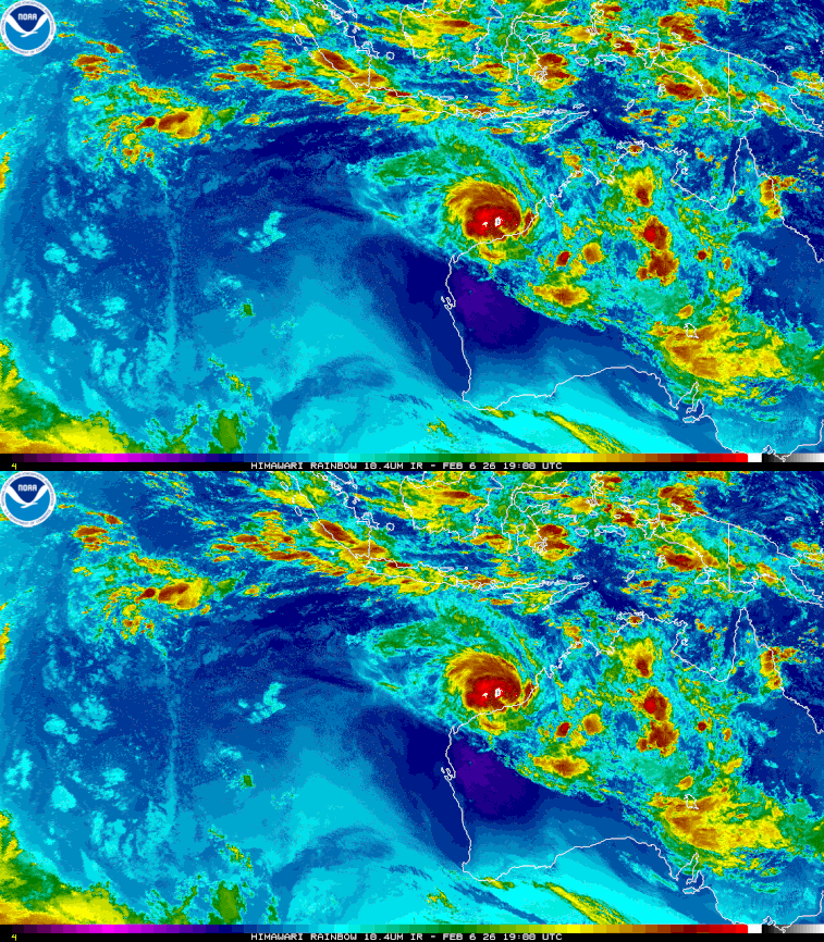
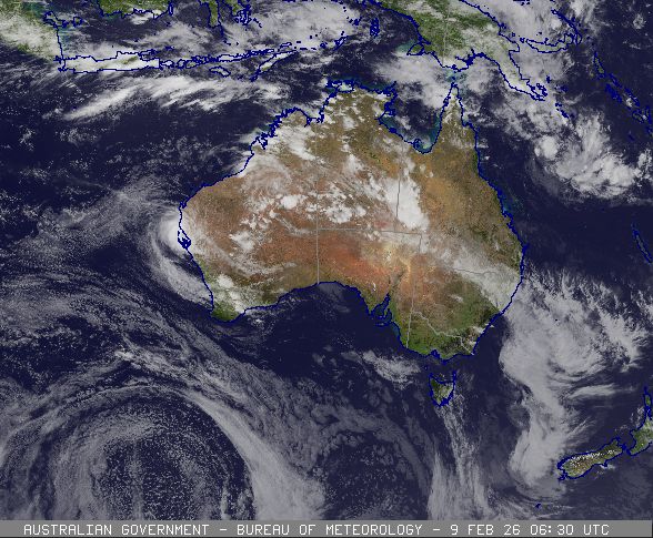
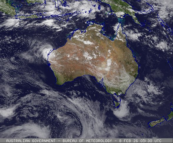
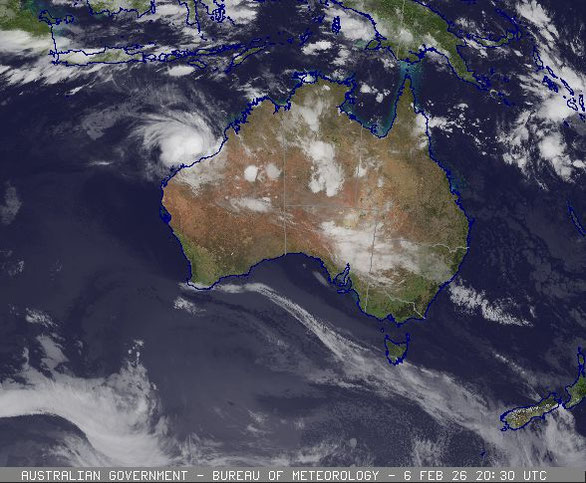
Severe tropical cyclone Mitchell formed on the Pilbara coast northwest Western Australia and weakened while passing over Carnarvon.
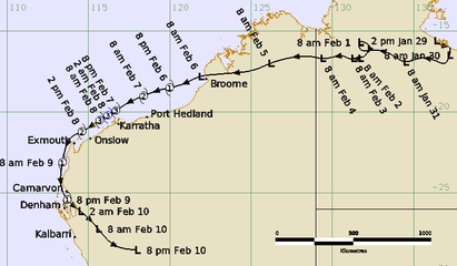
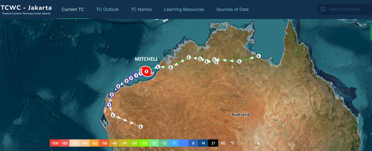
Severe Tropical Cyclone Mitchell began as a tropical low over the Northern Territory, producing significant inland flooding before intensifying over waters west of Broome. It then tracked west parallel to the Pilbara coast, reached Category 3 strength, and later weakened below cyclone intensity as it crossed the west coast near Shark Bay.
A tropical low (21U) formed over land on the western side of the Gulf of Carpentaria and moved west producing days of heavy rainfall across the Northern Territory. This resulted in the Daly River reaching major flood levels and caused the evacuation of about 250 people from the nearby community of Nauiyi (Daly River).
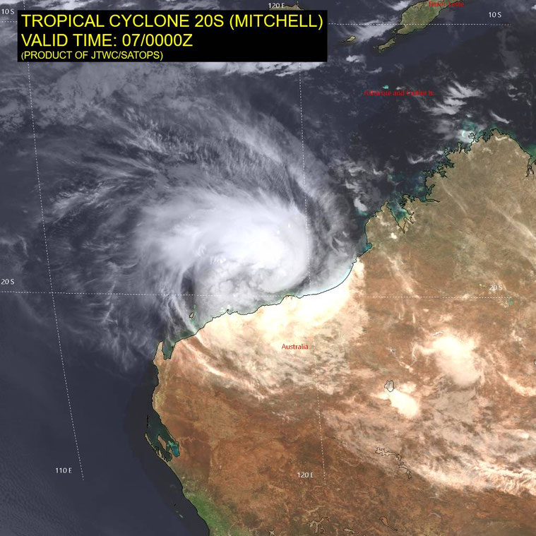
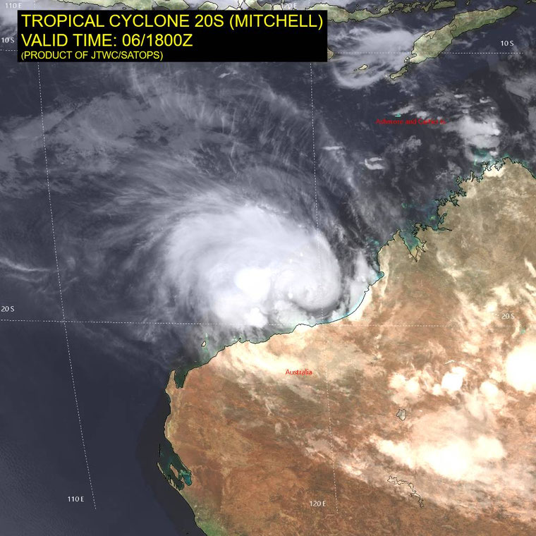
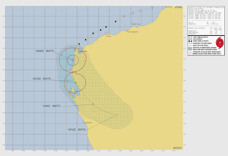
The low continued westward across the Kimberley and moved offshore just north of Broome where it quickly intensified into a tropical cyclone at 2200 AWST 6 February 2026. Mitchell moved west southwest, parallel to the Pilbara coastline and intensified into a Category 3 system by 2000 AWST 7 February, passing just to the north of Dampier and Karratha.
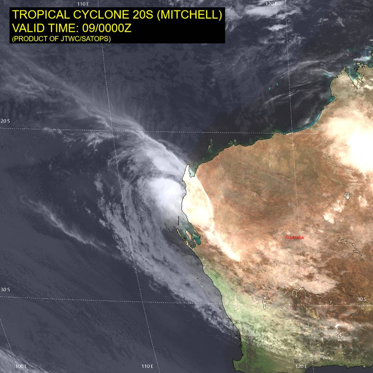
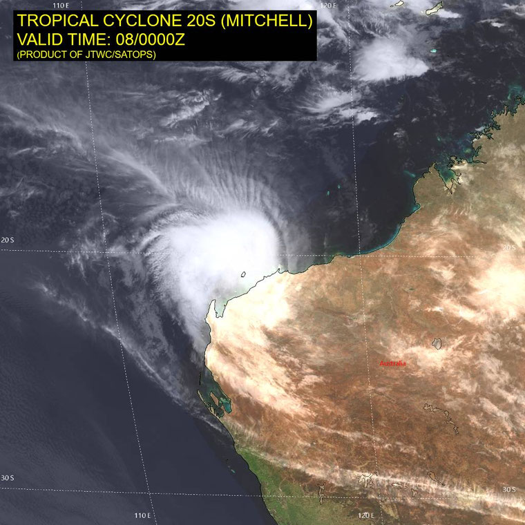
During 8 February, Mitchell weakened to Category 2 strength and moved around the North West Cape, offshore from Exmouth, before turning south. The system moved down the upper west coast as a Category 1 cyclone before weakening offshore just south of Carnarvon, it finally crossed the coast near Shark Bay around 2300 AWST 9 February before weakening inland.
Mitchell did not pass close enough to coastal communities to cause any significant wind damage on the Pilbara coast however there were significant disruptions to offshore industry operations for several days. Further south strong winds caused significant banana crop losses in the Carnarvon area, while localised winds impacted some structures in the Wheatbelt. The strongest wind gusts recorded during Mitchell were:
Location Gust km/h (knots) Time in AWST
Legendre Island 168 km/h (91 kn) 1906 7 February
Barrow Island 149 km/h (80 kn) 0809 8 February
Onslow Airport 120 km/h (65 kn) 1328 8 February
Learmonth Airport 119 km/h (64 kn) 2329 8 February
Carnarvon Airport 107 km/h (58 kn) 1537 9 February
From www.bom.gov.au
Alternative Track Maps
Satellite Images