Tropical Cyclone Ellie


Track map of tropical cyclone Ellie, 22/12/2022 From JTWC.

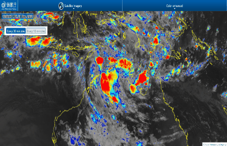
The Australian Weather Bureau named Tropical Cyclone Ellie on December 22 2022. Tropical cyclone Ellie developed near the Kimberley coast on December 22 2022 as a category 1 tropical cyclone prior to making landfall. 


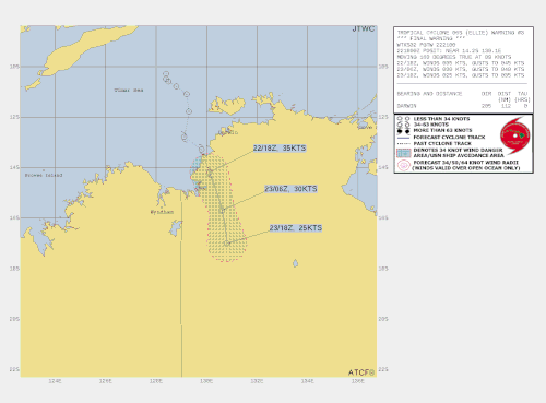
Tropical Cyclone Ellie (06U) crossed the coast at 11pm CST in a sparsely  populated location southwest of Daly River Mouth. The system continued to display a well-developed circulation on Darwin and Wyndham radars as it tracked to the south over land. TC Ellie continued moving southward under the steering influences of a mid-level trough to the southwest and a mid-level anticyclone to the northeast. Due to continued proximity to the ocean coupled with a low-shear atmospheric environment, the system weakened and proceeded slower than normal. 


News articles about TC Ellie:

Crisis 24 update 1


Forecast track map of Tropical Cyclone Ellie,  December 23 2022, Image from www.bom.gov.au.
Forecast track map of Tropical Cyclone Ellie, December 23 2022, Image from www.bom.gov.au.

Satellite image of tropical cyclone Ellie, December 23 2022. Image from https://www.bom.gov.au.
Satellite image of tropical cyclone Ellie, December 23 2022. Image from www.bom.gov.au.

Satellite image of tropical cyclone Elli, December 22 2022. Image from JTWC.