Tropical Cyclone Winston


Tropical cyclone Winston passing over fiji, images from JMA
Forecast track of Ex-TC Winston (25/02/2016), images from www.bom.gov.au
Tropical Cyclone Winston track map over Fiji  issued 25 February 2016 , from Fiji Meteorological service
Tropical Cyclone Winston track map over Fiji issued 25 February 2016 , from Fiji Meteorological service
Tropical Cyclone Winston track map, from JTWC

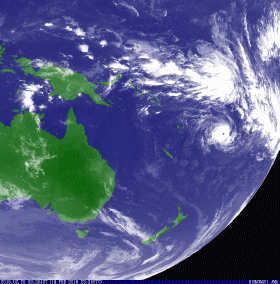
From 11 to 24 February 2016, Tropical Cyclone (maximum wind speed of 296 km/h) WINSTON-16 was active in the South East Pacific. The cyclone affected Fiji as a category 5 Severe Tropical Cyclone. Estimated population affected is 0.743 million people.


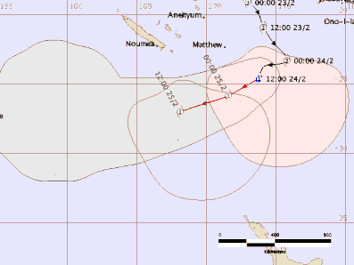
Tropical Cyclone (TC) Winston was named by RSMC Nadi at 1pm on February 11th, located to the east of Vanuatu.  From then, TC Winston tracked southeast, then northeast, turning westward and moving over Fiji and then moved southeast. Tropical Cyclone Winston was located near 22.1S 174.9E lying well southeast of Vanuatu and southwest of Fiji on Wednesday 24th February. 

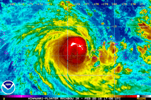
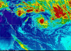
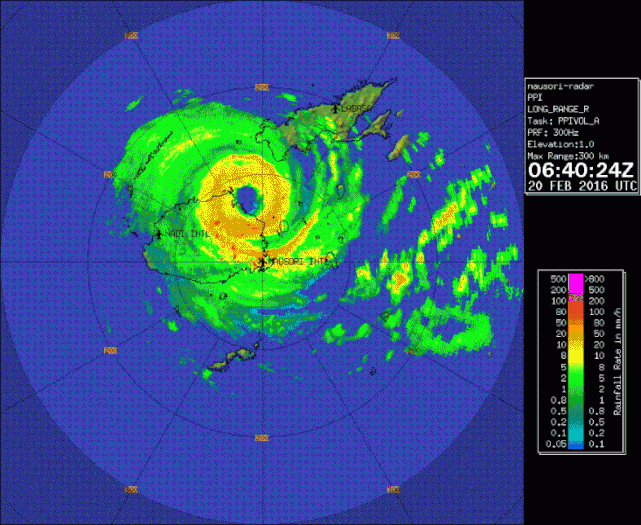
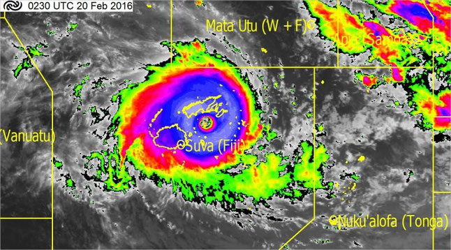
Category 5 Severe Tropical Cyclone (TC) Winston was the strongest category 5 tropical cyclone to make landfall over Fiji. TC Winston made landfall in Viti Levu, Fiji on February 20 2016. Prior to landfall the estimated central pressure was 915 hPa, with maximum winds near 230 km/h.


TC Winston after passing over Fiji, From NOAA

Tropical cyclone Winston radar image showing TC Winston about to make landfall in Viti Levu, Fiji, from NZ meteorological service blog.
Tropical cyclone Winston radar image, about to make landfall in Viti Levu, Fiji, from NZ meteorological service blog.
Tropical cyclone Winston at 3.30pm Saturday 20th February 2016. Note the exceptionally clear ‘eye’. This image is from JMA, with colour by NZ met service

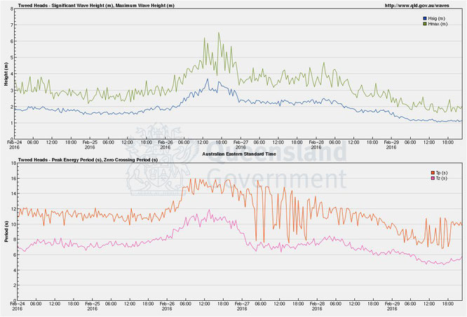
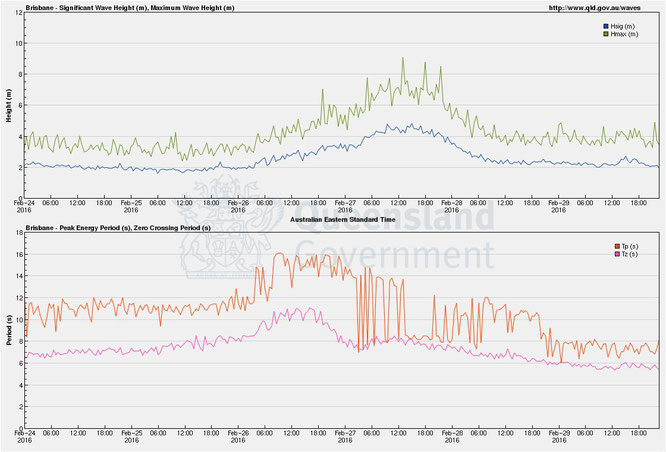
TC Winston generated large swells on the east coast of Australia

On February 26 2016 Tropical Cyclone Winston entered the Australian basin as extratropical cyclone and made landfall over Queensland as a tropical low quickly degenerating into a trough, on 3 March. Large swells developed ahead of Ex-TC Winston on the Queensland coast with significant wave heights of 3-5m and wave period of around 15 seconds.

Wave height and period at Tweed Heads during the passage of TC Winston, from www.qld.gov.au/waves
Wave height and period at the Gold Coast during the passage of TC Winston, from www.qld.gov.au/waves
Wave height and period east of Stradbroke Island (Brisbane) during the passage of TC Winston, from www.qld.gov.au/waves